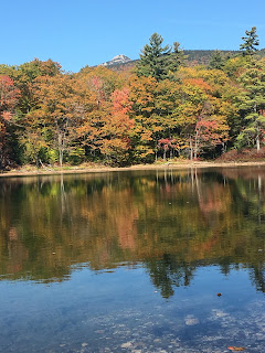
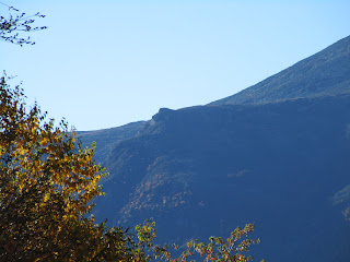
Saturday, October 21, 2017

Short Hikes to Big Rewards

Laurie and I went to New Hampshire this week. I couldn't resist the 70 degree days falling on my days off. For Laurie it was also too good to be true. She found a way to rearrange her work schedule so she could also have Friday off. We left Thursday night after we got out of work. We drove up in the dark and set up the tent. When we woke up we were ready to play.

The plan was to go to as many nice spots as we could that were on short hikes. After last week's big hikes over three big mountains, I was quite content to do some short easy trails. We spent most of our time in the eastern White Mountains. I don't get that way too often because it is such a long ride. I might be missing out. We went to some really cool spots.

The first place we drove to was Lost Pond in Pinkham Notch. The trail is only about a half mile each way. We got there after sunrise but before the sun rose over Wildcat behind us. The parking is in the huge Pinkham Notch parking lot across the street.
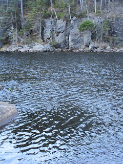

A pretty cool ledge was across
from the sitting rock we were on.


For a short distance the trail runs along this pretty brook.
After our time at the lake we went back the way we came. Instead of going back to the car we went up Square Ledge. This is a rocky ledge I believe on Wildcat. It is accessed from the same trailhead. The hike goes up the hill until you reach the bottom of the ledge. Then it gets really steep as it goes up around the cliff. It is only a half mile but the end will warm you up. The view is directly across from Big George. There is an excellent view into Huntington Ravine.
The trail to Square Ledge goes under this awesome overhang

Looking up the cliff from the trail

Pinkham Notch Visitor Center in the middle.
The ravines of Washington above

Without even moving the car we went to a third hike. We walked up the Tuckerman Ravine Trail ten minutes to Crystal Cascades. This waterfall used to be my favorite. The last time I was there I was still using film. I can't believe how fast time flies.


From there we headed to the Wildcat Mountain Ski Area. There is a small waterfall I only learned about last week named Thompson Falls. We took the mile hike out knowing it would be but a trickle. We still wanted to see it. Sure enough, not much water was going over. Still it was pretty enough to make the hike worth it. 
After we got back to the car we headed south towards Conway. We decided to sleep in a backcountry shelter at a mountain pond. It was an easy hike even with our home for the night loaded on our back. When we got there we had the place to ourselves until well after dark. A lone hiker came by at 10 pm. Earlier we laid down by the shoreline and looked at the stars for an hour before we went to bed. 

Our shelter for the night. Laurie slept in the tent. I slept in my
bag outside the tent (the red thing in middle of photo)
 
When we got up it was extremely warm. We packed the gear and walked out. We heard a loon call. We had also scared up a rough grouse. After we got to the car we had to come up with a game plan. We did everything on my agenda Friday. We decided to hike out to another mountain lake that neither of us had ever been to. 

It was a Saturday in the mountains that was over seventy degrees in October. The peak foliage was just below the Kanc. Needless to say we were not expecting solitude, but we did try to avoid the tourist meccas on the Kanc and Franconia. We found a lake that was a mile from the road. The trail was easy. At the pond there is an outstanding view of Mount Chocoura. We hung arond the lake for over an hour eating snacks and lounging on some huge downed pine trees. 

As I said, we did not expect solitude. However this lake had it. We never saw another person on the hike in or out. No one was at the lake. The warm sunlight was enough to make one fall asleep in the quiet setting. It was an excellent way to spend a morning.


After we came out we drove down Route 16 and stopped at the classic view of Mt Chocoura and Chocoura Lake. It was perfect. The water was flat. There were great colors on the mountain. At least five kayakers were enjoying this perfect day.


Sadly it was getting late. We made our way west on the Kanc and got a lte lunch in Lincoln. We made one more stop at Mirror Lake. Just like everywhere else, the water was flat. A lot of people were fishing. This leads me to believe trout were just stocked. I've been to this lake multiple times and barely ever see anyone.


If we somehow manage another week of warm weather, it will be hard for me not to head back. I would love to spend the night on Cabot and knock out one more 4000 footer. If this was my last time up for the year, it was a great way to go out, but I already miss it.

A very cooperative toad


Friday, October 13, 2017

Three Mountains over Four Thousand Feet- Wildcat A, Wildcat D, and Mt. Carrigan

The weather forecast for the White Mountains was going to be crystal clear with a high temp of 60 degrees on my days off. I could have stayed home and went saltwater fishing, but  I figured that kind of weather is rare for mid-October. Last week when I went to New Hampshire with Laurie really got me thinking how much I missed it this year. I know it is a sentimental cliche' but the mountains were calling.

I drove up Wednesday night after the evening rush. I found a site roughly 9 pm. I set up camp and got in my sleeping bag. It was 45 degrees when I went to bed. I woke up the next morning pretty cold. The sky cleared and the sky lit up with stars. Waking up cold wasn't a bad thing, it got me out of bed and in my car. When I got out of my tent, it was stiff with frost.  I left for my first hike at 6 am, I had a two hour drive. One bonus of getting up so early, I saw two moose, a mother and a baby on the drive through Crawford Notch

Small Waterfall on 19 Mile Brook
The goal for the day were the two Wildcat peaks over 4000 feet. The Wildcat mountain is actually a ridge. There are five peaks, but only two qualify as official 4000 footers. My plan was to hike in from the north, go over the ridge and come down Wildcat D on the ski trail. The idea of using the ski trail was given to me by Steve Smith, the Mountain Wanderer. Besides being easier, much more importantly, I could look at views the whole way down instead of spending most of my time slogging through the woods.

I started on the 19 Mile Brook Trail to Carter Notch. This trail has a good uphill grade and I made it fairly quickly. At Carter Notch comes the hardest climb of the day. You rise 1100 feet in only .7 miles. I mentally prepared for the worst, but it wasn't that bad. Once on top, I was on the summit of Wildcat A. There is a view near the summit looking east. I didn't spend any time at the view because I assumed, being on a ridge, there would be multiple viewpoints.
A look back at Carter Dome and the Carters

From A, you go down then up (B) then down, then up (C) then there is a very long downhill of several hundred fairly steep feet. Once at the bottom, you climb back up to get to Wildcat D. This summit is where the gondola and one of the ski lifts end.  There had only been a couple spots from A-D that I could see much of anything. However, the view from the top of the ski slope is fantastic. I spent a half hour soaking in the view and the sun. The temperature warmed up to about 60 degrees and there wasn't any wind at all.
Big George with looks into Tuckerman and Hunnington Ravines

Adams and Madison

I took the ski trail back down to my car. It still took me almost two hours to drop 2000 feet out of the sky. The view of Washington, specifically its ravines (Tuckerman and Hunnington) was just amazing. There is also a terrific view of the Lionhead, a formation on Big George. It was really clear (although my camera didn't think so).
Some pretty foliage on the way down

The Lion Head


After I got down I had three miles of road to get back to my car. However, I thought ahead. I brought my bike. I stashed in the morning, locked to a tree. The ride back was almost entirely downhill. In the three miles, I pedaled for around 90 seconds. When I got back to the car, I drove to a sandwich shop because I craved a turkey sub all day. I got it to go. I then drove to Saco Lake and ate it there. From the lake I drove back to camp with 10 minutes to spare before dark.
Planning ahead


Mt Carrigan

When I was coming down the ski slope, I felt some pressure in an outside tendon in my knee. It really started to hurt the last 1/2 mile. Besides that, my foot is still hurting and it really tightened up when I got off of it. Because of these things, I thought I would be taking it easy Friday and planned a few shorter hikes if I woke up with pain.


I was actually hoping to have my knee or foot hurt in the morning. It would give me an excuse to not hike Carrigan. So, of course, when I woke up, everything was fine. The knee felt fine and my foot felt like it normally does when I didn't just hike 8 miles on it.
Easy flat part of Signal Ridge Trail

So I packed my tent (rainfly was frozen again) and drove off to Sawyer River Road. I packed my backpack and off I went to bag Carrigan.  Carrigan is 4680 feet high. It sits pretty much in the middle of all the other 4000 footers. Because of these two facts, it has one of the best views in the White Mountains. From the summit you can see 43 of the 48 4000 mountains over four thousand feet. This ties it with Washington with the most summits seen.  I had planned on doing this mountain as my last four thousand footer. However of the three that I have left it was the closest and probably the easiest ( definitely easier than the Adams/Madison hike). Also, being so clear today, I was guaranteed the beautiful views I was saving it for.
Emerging from the scrub, I still had the main summit in
front of me, but I had views

The hike is ten miles round trip. The elevation gain is about 3200 feet.The first two miles are almost completely flat. This of course, means the majority of the 3200 feet is done in the last three miles. Needless to say, I flew through the first two miles. You know immediately when you start climbing. Halfway up you see the giant mass of Carrigan through the trees a couple miles away and fifteen hundred feet above you. It is a long three mile slog up the mountain. The term is relentless.

Near the top, you come out to a beautiful view on Signal Ridge. The view towards the Presidentials is to the right. In front of you likes the big rounded summit of Carrigan. It is still a few hundred feet above. From Signal Ridge you can see the firetower on the summit. This gave me a second wind and I pushed pretty quickly.
Lunch wouldn't have tasted better if it were lobster and
shrimp cocktail

Firetower from below. Tough to get a good close up

The Giant Stairs. One of my favorite places


From the summit, the view is 360 degrees. I counted many of the mountains I had climbed. I could look deep into the Pemi Wilderness. Unlike Thursday, it was much windier. The firetower was completely exposed so I only stayed on it for a few minutes. I had lunch and headed back to Signal Ridge. The view from the ridge was awesome, but Carrigan blocked the wind. So I sat there for 20 minutes soaking it in.
The sky was bright blue. I think I might need a new camera

The hike down was brutal. It took a full two hours to get to the flat last two miles. I honestly couldn't believe I had hiked it going up. Just like the climb, the downhill steps were relentless. I made it out of the woods at 4:45. Leaving me only two more hikes to complete the New Hampshire 4000 footers.

I drove down Bear Notch Road to the Kanc. I picked up a chocolate milk and headed home. If the weather is as nice next week on my days off, I can't promise I won't be heading back to the hills!

Summary
18 miles hiking
3 of my last six four thousand footers
Animals seen- 2 moose, yellow rumped warblers, juncos, yellow crowned kinglets